
Geolocation of assets
We review each asset in our representative sample of infrastructure assets to determine the actual geographic location and spatial extent in a process known as geolocation. The geolocation process is a mixed-methods procedure of manual checking and automated extraction. First, the assets’ addresses are manually verified and then used as inputs into an in-house geo-shapes extractor[1] that automatically outputs the assets’ boundaries in three steps: First, it extracts all geospatial outlines (in the form of a polygon, line, and points) within a few kilometres of a given locality. Then, the extractor combs through all the tags of the outlines and filters them according to the defined mapping (e.g., power plants would be filtered for the industrial land use tag). Finally, the resulting outputs are the filtered geospatial outlines for a particular asset (see figures below). Depending on the asset and its location, the accuracy of the extractor can vary. Hence, there is a need for additional manual checks, re-verification, and re-generation of geospatial outlines. The manually verified outlines are generated using a variety of commercial and open-sourced geographic information system platforms, such as ArcGIS and QGIS, and map sources, such as Google Satellite Imagery and Maxar Satellite Imagery.
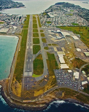
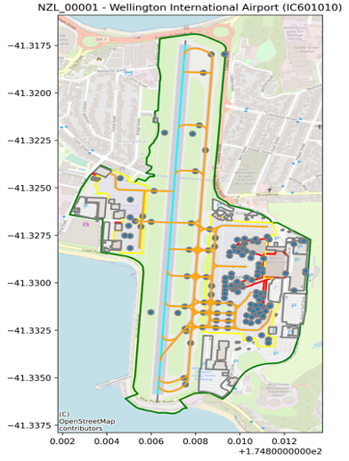
Successful geo-shape extraction of the Wellington International Airport.
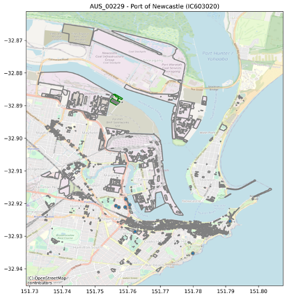
Challenging geo-shape extraction of the Port of Newcastle.
[1] The Geo-Shapes Extractor (‘Extractor’) is a Python module developed by Scientific Infra & Private Assets for the purposes of automating the extraction of specific assets’ boundaries. The extractor allows to take TICCS and further information such as asset name and coordinates as inputs. With an approximate locality from the input information, the module extracts an asset’s boundaries based on a manually defined mapping between TICCS categories, basemap tags, and values of these tags.