
Generic radius vs. detailed asset boundaries
Typical market solutions calculate physical risks based on an approximated buffer of a point provided by the user. This will yield risk estimations that are less precise than our approach, where detailed asset boundaries are used. The example of the Dalmuir Sewer Treatment Plant in the United Kingdom and 100-year flood risk calculations demonstrate that the generic radius approach results in an underestimation of flood depth of at least two times compared to the detailed asset boundary approach (see figures below).
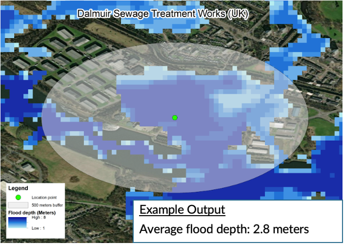
Generic buffer of 500 metres and resulting flood depth estimation
(own mapping illustration)
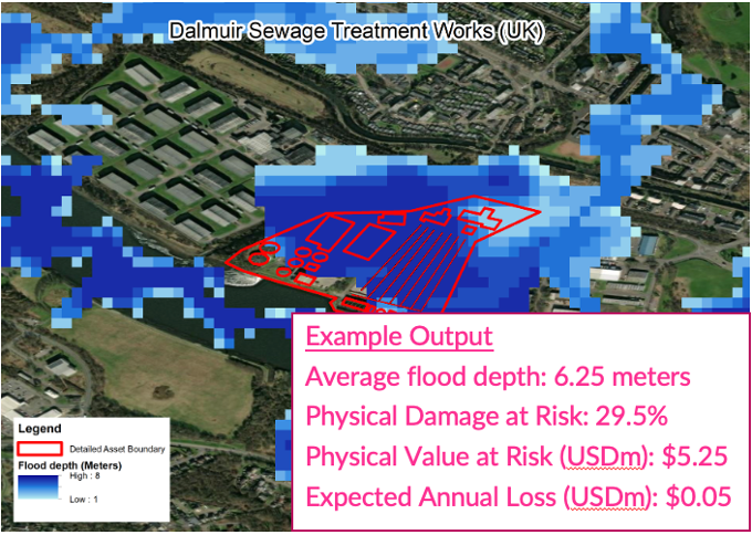
Detailed asset boundary and resulting flood depth and risk estimation
(own mapping illustration)
As infrastructure assets can span over large irregular areas (like airports or utilities) or stretch across hundreds of kilometres (such as roads and wind farms), physical risk metrics based on single-point or vector geolocation are unlikely to be representative of the physical risk exposures of an asset. A more accurate assessment requires knowing the precise spatial footprint of assets and the varying levels of physical risk that could materialise across its entire length or area.