
2.3.1 General modelling approach
Our physical risks quantification model approach is a stepwise progression from the sourcing of inputs to the geospatial transformation that will result in the quantified physical metrics for each asset. The figure below summarises our approach.
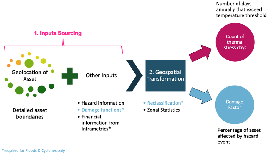
Steps of our general modelling approach (own illustration)
First, the inputs sourcing stage is a series of simultaneous processes to extract the key inputs (asset boundaries, hazard information, financial information, and damage functions) required for each asset. Asset boundaries define the exact location and spatial extent of each asset. Global hazard information maps are our proxy for exposure as they provide information regarding the extent, magnitude, and corresponding hazard value of a specific hazard event. Additionally, we utilise damage functions to bridge the gap between exposure and vulnerability, as such functions model specific hazard events and the corresponding damage proportion after factoring in several variables, such as geographical region, construction, and material types, among others (Prahl, 2016). In the second step, we transform and combine the inputs via one or several geospatial processes. These processes combine hazard maps with damage functions to derive averaged damage factors per asset. Finally, we yield the calculated physical risk damage factors (for floods and storms) or count of days above the temperature threshold (for thermal stress) on the asset level. To conclude, we discuss the robustness of our models.
Prahl, B.F. (2016). On damage functions for the estimation of storm loss and their generalization for climate-related hazards. (Dissertation). Retrieved June 18, 2023, from https://d-nb.info/1124841245/34